

The Archaeological Record
The area around Dumbleton appears to have been inhabited for a very long time. Evidence of this has been gained from aerial photographs, finds made by individual people, and artifacts uncovered during the construction of the Esso Midline pipeline in 1985, and more recently development of Golden Hay Field 2023-2026. An initial survery of the field led to the condition to perform a complete survey before building works begin. See Golden Hay Field Archaeology which includes finds from late Iron Age and and Roman period (c. AD 120)
A fragment of a Neolithic polished flint axe was found in a field to the east of the village during the construction of the pipeline and a number of worked flints, including a transverse arrowhead, have also been recovered.
A number of Romano-British pottery peices were found near Lane Farm, Leyfield Farm and Dumbleton Mill and a Roman coin was found at Hill Farm.
The presence of a Romano-British settlement has previous thought to lie to the east of the village, and has now been confirmed by the archaelogical dig on Golden Hay Field in 2026. This site seems to be on the line of a Salt Way (see below) which ran south to Lechlade, via Hayles, and north via Ashton-under-Hill to Droitwich. The Salt Way, or Salter's Way, was originally thought to have passed to the west of Dumbleton Hill but this evidence indicates that it almost certainly ran to the east of the hill.
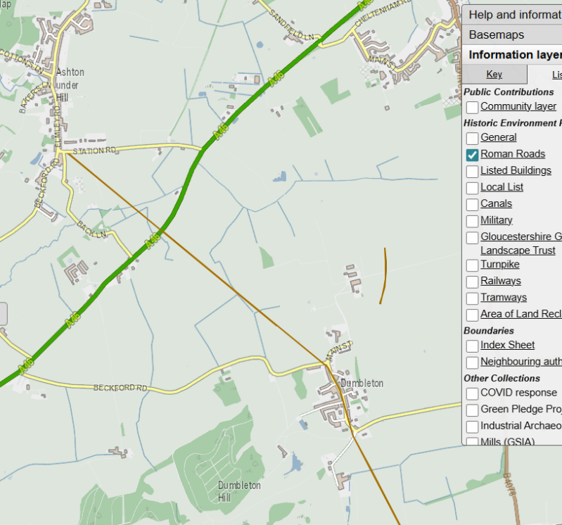
Acknowledgement: The image here is taken from "Know Your Place" and is provided for reference only. You can visit the interactive map and see the latest published updates here: https://maps.bristol.gov.uk/kyp/?edition=glos

The History of the Salt Way (extract from https://www.saltwayactivitygroup.org.uk/history)
The Salt Way is an ancient trade route with deep historical roots, primarily used to transport salt from Droitwich in the Midlands to various regions across England. This route is believed to be part of a broader network of Salt Ways that radiated out from Droitwich, a region famous for its naturally occurring brine, and played a significant role in trade throughout the Iron Age, Roman, and medieval periods.
Origins and Early Use
Salt has been an important commodity for centuries, and its trade dates back to the Iron Age. The Salt Way, alongside other salt routes, was used to transport salt from the brine springs of Droitwich, a place where salt naturally bubbled up from the ground at a concentration twenty times stronger than sea water. This unique natural resource made Droitwich an important center for salt production. After boiling off the water from the brine, the result was a high-quality salt that was both cheaper and purer than other salt sources. In a time when salt was a precious and universally required product, the Salt Way became a vital trade route for moving this valuable commodity.
Roman Influence and Expansion
By the time of the Roman Empire, Droitwich had become a significant hub for salt production, known as ‘Salinae,’ meaning ‘Salt Works.’ The Romans recognized the importance of salt, even paying their soldiers in it—a practice that highlights just how essential salt was to the economy and daily life. The infrastructure built by the Romans helped to expand the Salt Way, which was already a key route for transporting salt.
As the Roman Empire advanced, they developed and refined the techniques for brine extraction and salt boiling. These methods led to a more efficient and larger-scale salt production operation, which continued to thrive long after the Romans left Britain.
Other Archaeology in and around Dumbleton
A moated site survives near Banks Farm and is indicated on a Dumbleton Hall Estate Sale Map, dated 1875, by such field names as "The Moat" and "Moat Orchard".
Pottery has been found near Leyfield Farm, Cullabine Farm and Dumbleton Mill. The mill, millpond, weir and mill finds are all probably medieval.
The Church, the site of the original Dumbleton Hall, the roads, the old rectory and the fishpond to the west of the cricket ground all indicate that this area is the oldest part of the village.
Associated with Dumbleton is the "lost" village of Littleton. Accounts of the obedientars of Abingdon Abbey (1433-1434) refer to "..... the mill of Lyttleton in default of rent ...... and wholly decayed". A loop in the River Isbourne indicates its possible position. Roman sherds and pottery dated to the mid 13th century have been found. A human skull has also been recovered in the same area. The 1875 Dumbleton Hall Estate Sale Map shows fields with names such as "Littleton Green" and "Near Littleton"
Acknowledgement: The information on this page is based upon data kindly provided by Gloucestershire County Council Environment Department